Lot 167 TWO ANTIQUE MAPS ABOUT JAPAN
Reference: ART9991574
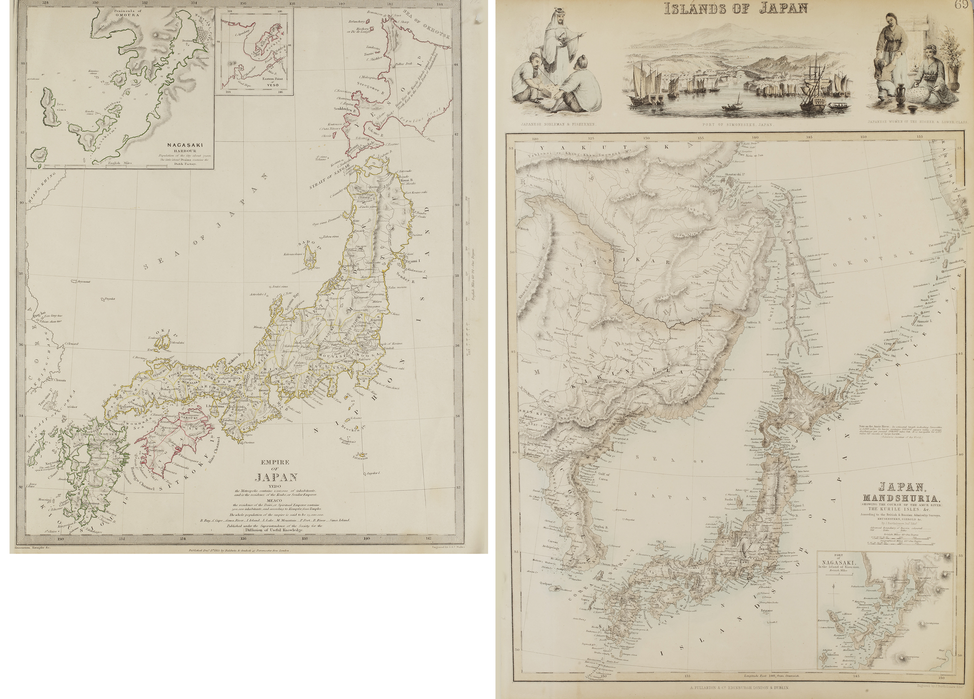
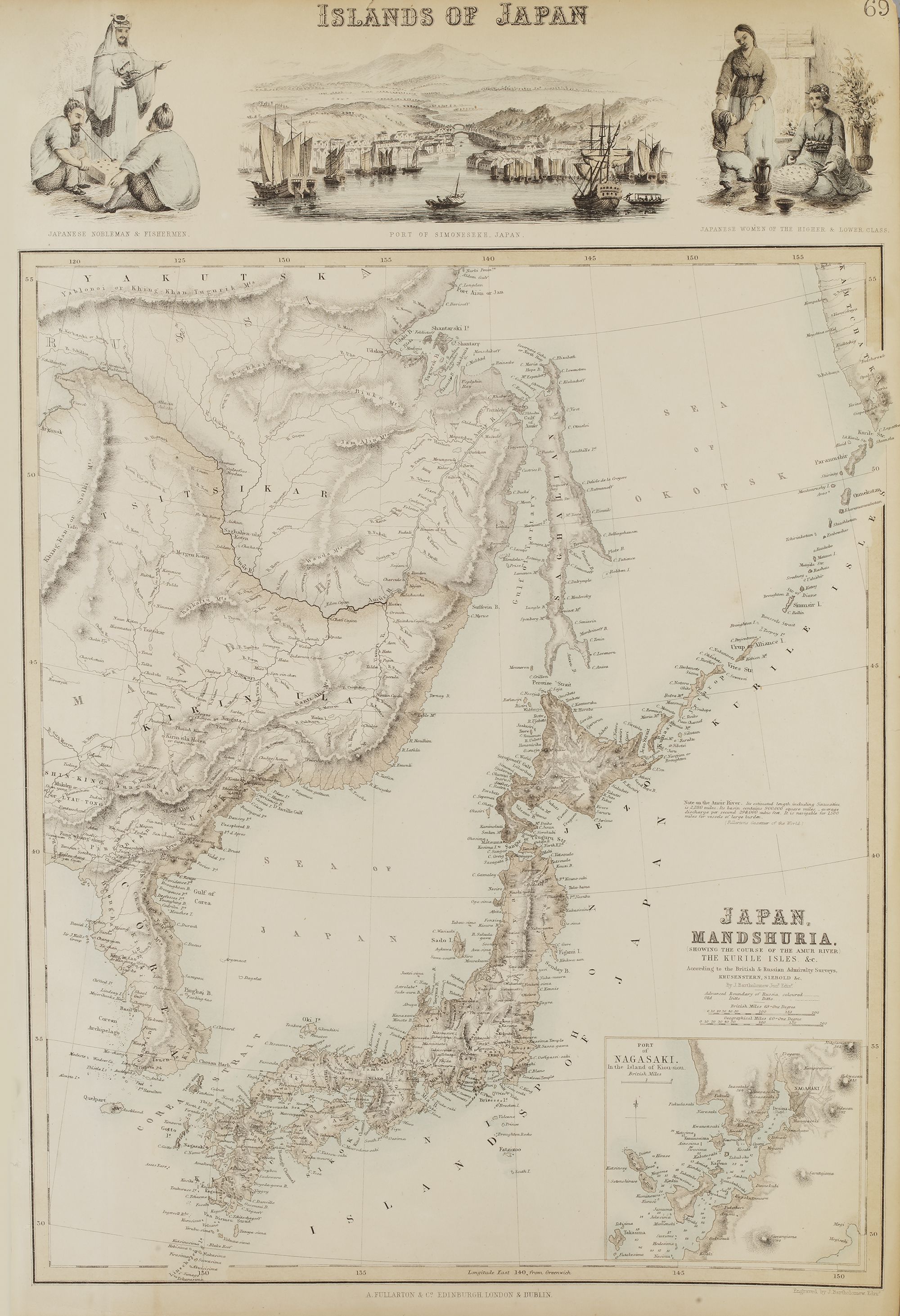
- Map of the Islands of Japan and Manchuria – A detailed 19th-century map depicting Japan and parts of Manchuria, with topographical details and geographic features. The map includes illustrated vignettes of Japanese daily life and the port of Simoda.
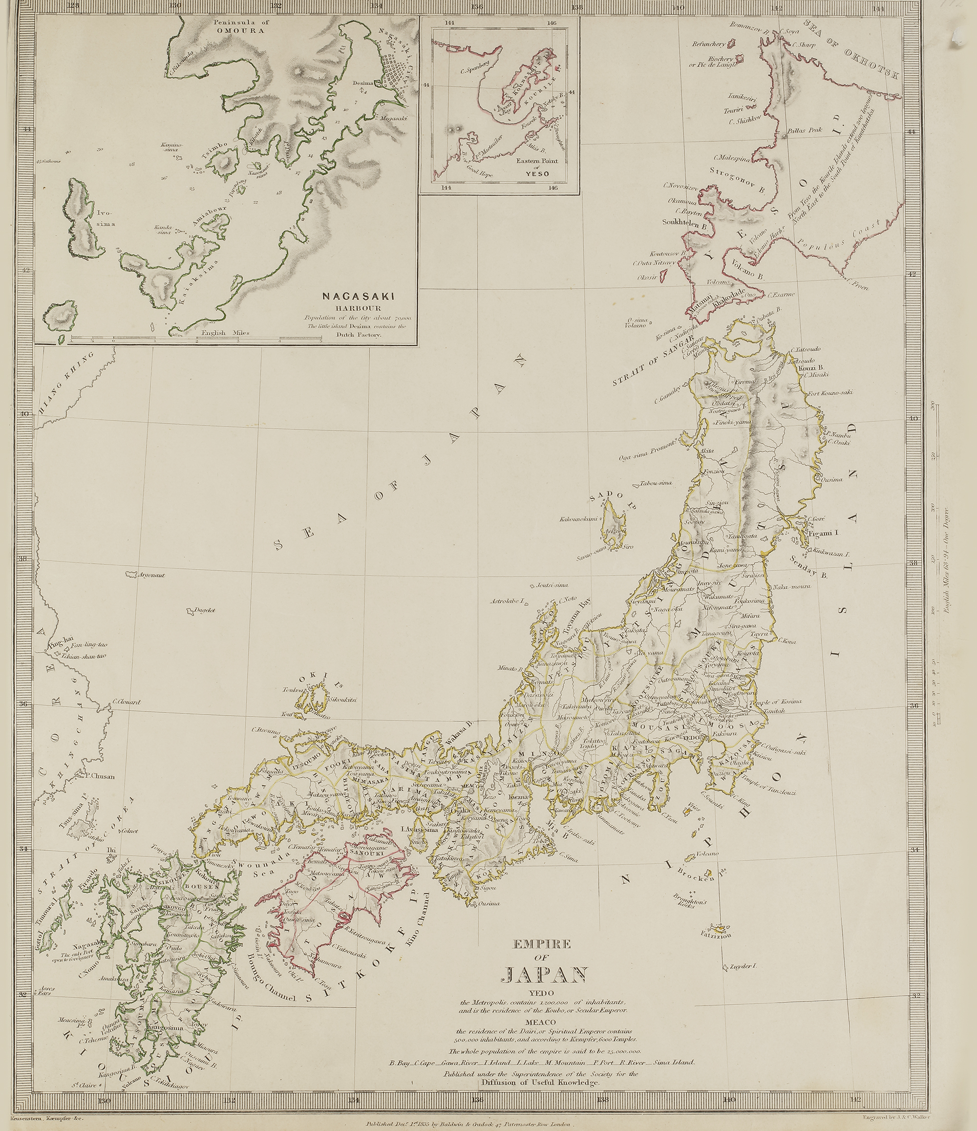
- Map of the Empire of Japan – A finely detailed historical map showing Japan’s territorial divisions, major cities, and coastal features. Insets provide additional details, including a close-up of Nagasaki Harbor and the northern island of Yezo (Hokkaido).
48 by 32 cm.
40 by 34 cm.