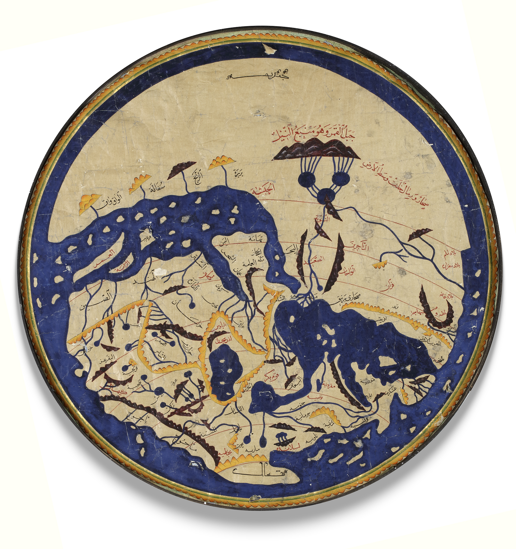
Lot 795 AL-IDRISI'S WORLD MAP IN NUZHAT AL-MUSHTAQ, 19TH-20TH CENTURY
Watercolor on paper, depicting Al-Idrisi's world map, the names of the places, the rivers and the mountains in yellow, black and red ink.
Note that south is at the top of the map.
Diameter 61 cm.
CATALOGUE NOTE
In the 12th century, scholar Al-Idrisi produced a map showing most of Europe, Asia, and North Africa for the first time. Al-Idrisi ranged widely, drawing on older knowledge and interviewing thousands of travelers to make his map the most accurate of its day. Muhammad ibn Muhammad al-Idrisi (circa 1100–66) was a 12th century geographer from al-Maghrib (North Africa). Born of noble lineage in Sabtah (the present-day Spanish enclave of Ceuta in Morocco), he studied in Cordoba. Al-Idrisi traveled extensively in the Mediterranean and Atlantic coastal regions, including North Africa, Spain, Anatolia, the northwestern coast of the Iberian Peninsula, and the coastline of France. Al-Idrisi gained the attention of Norman King Roger II (reigned 1130–54) of Sicily, who commissioned al-Idrisi to produce his masterpiece Nuzhat al-mushtaq fi ikhtiraq al-afaq, known as Tabula Rogeriana–the first descriptive geography of the world’s major population centers.