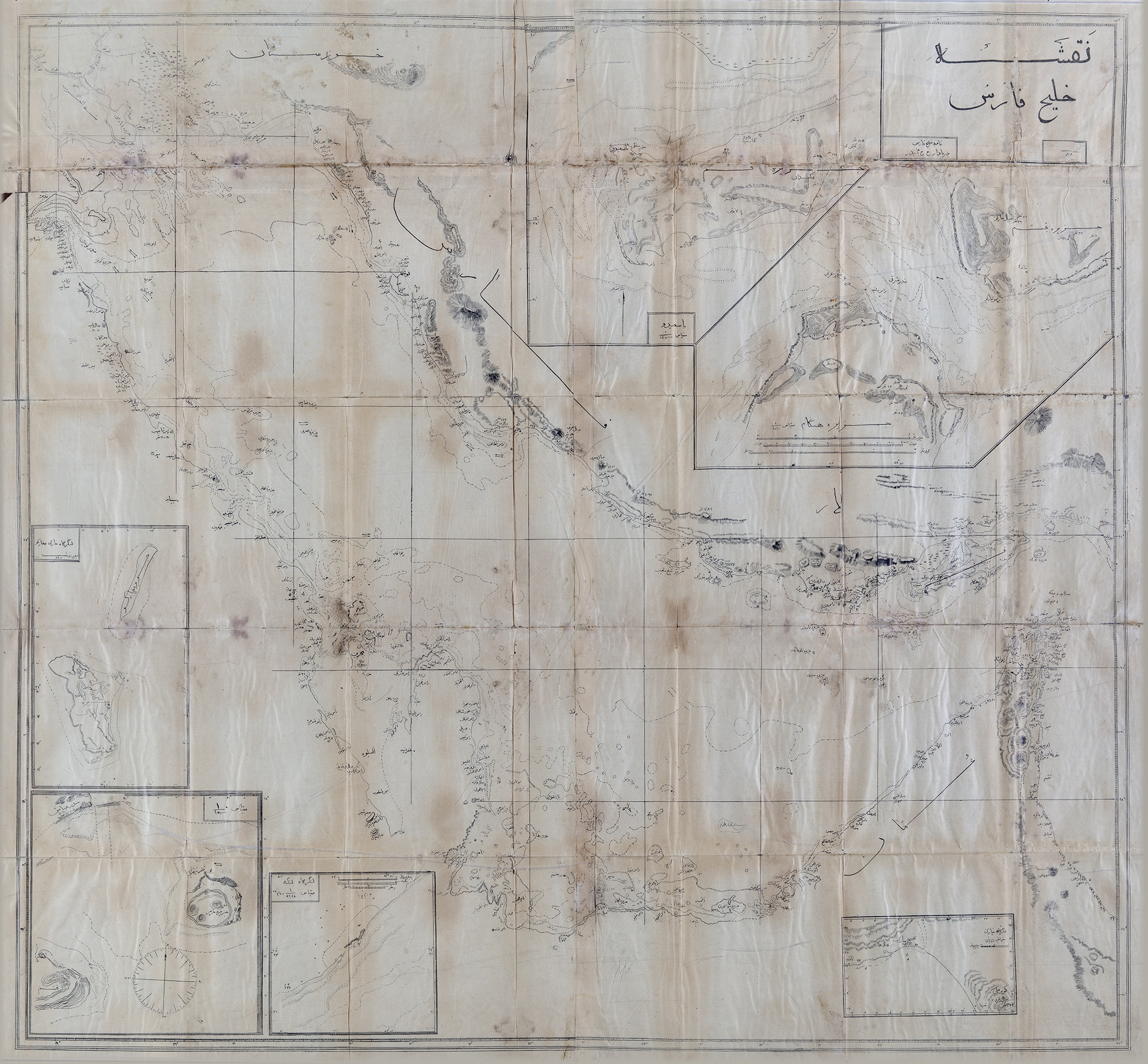
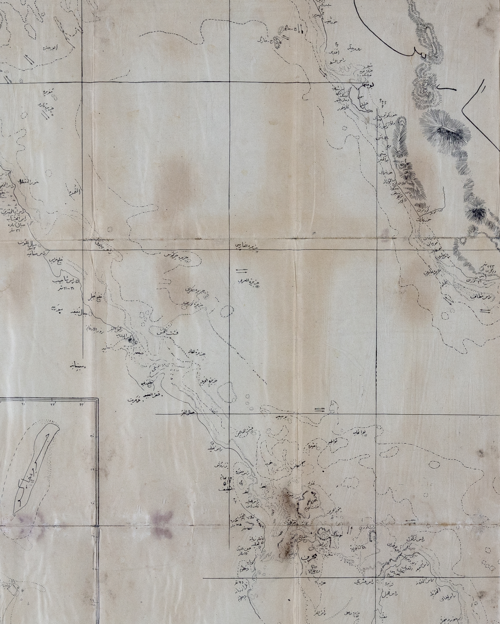
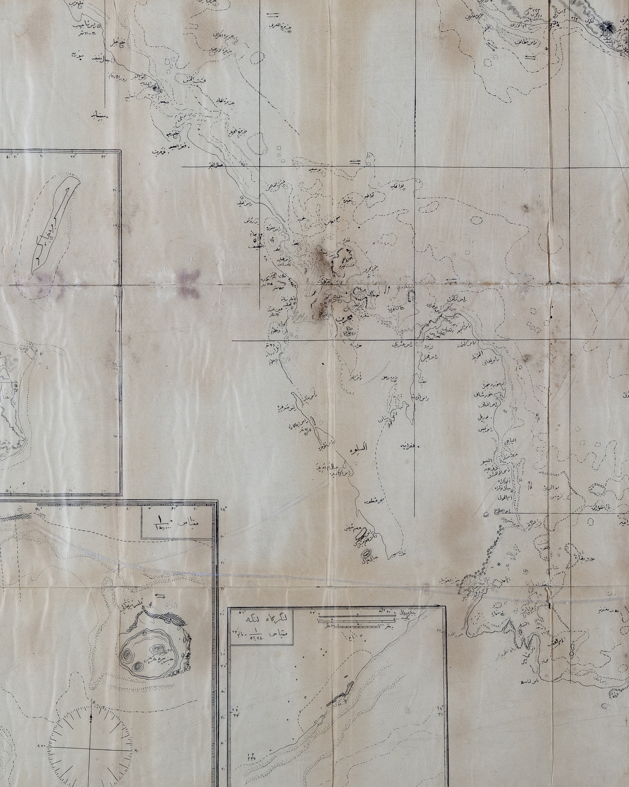
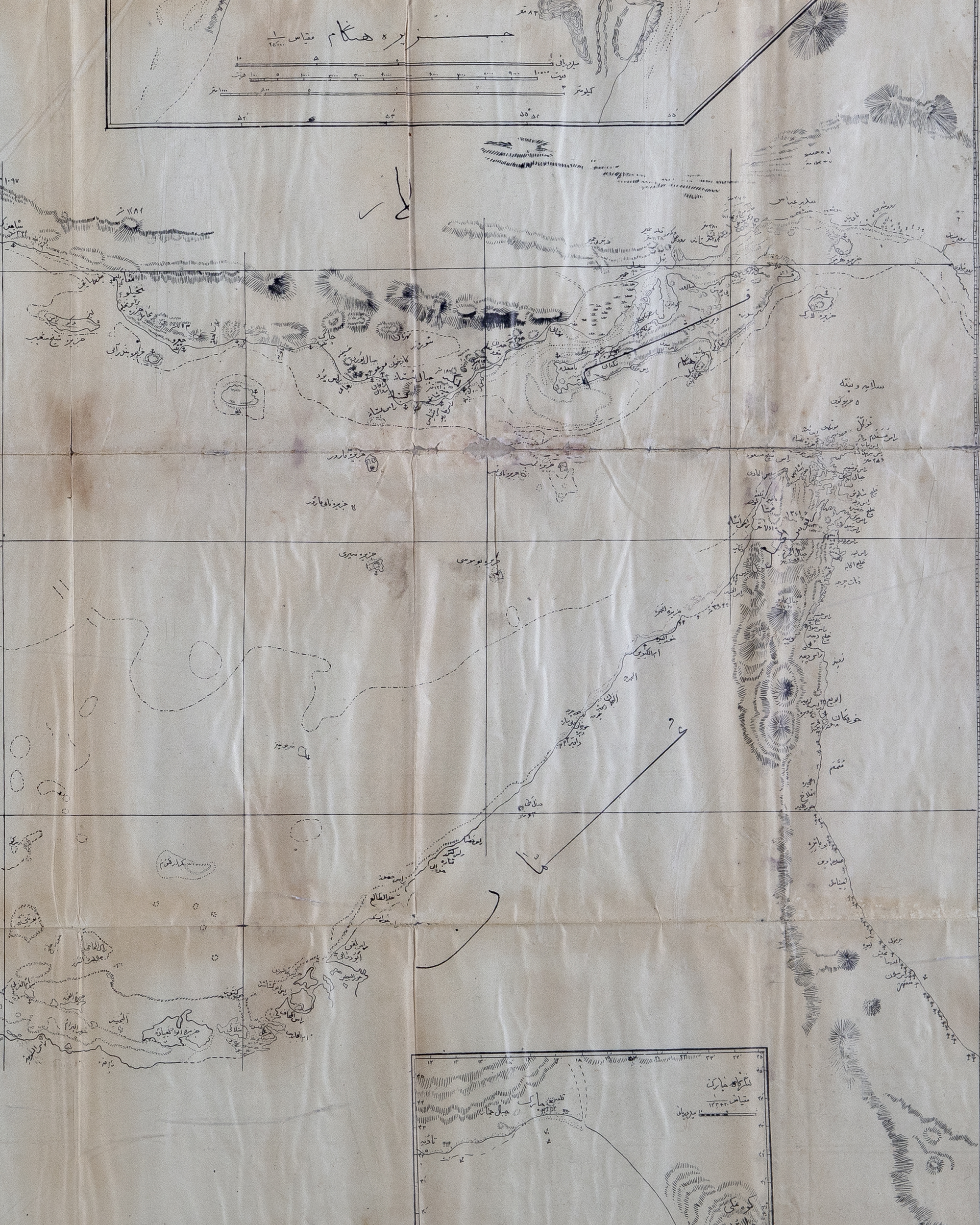
A HISTORICAL POLITICAL MARITIME MAP SHOWING THE ARABIAN GULF ALSO KNOWN AS PERSIAN GULF AND OMAN WITH THE ISLANDS/CITY PORTS IN THIS REGION,19TH CENTURY
Reference: ART4001092
A rare (could be printed or hand-sketched) maritime revised map of the Arab Gulf (known as the Persian Gulf). Showing the coast of he Gulf from Basra all the way through to Oman, with all the ports, cities, and towns on both sides of the Gulf. It may have been used for political or military purposes. On thin paper, written in black ink and footnoted in Persian calligraphy. 107 by 100 cm.