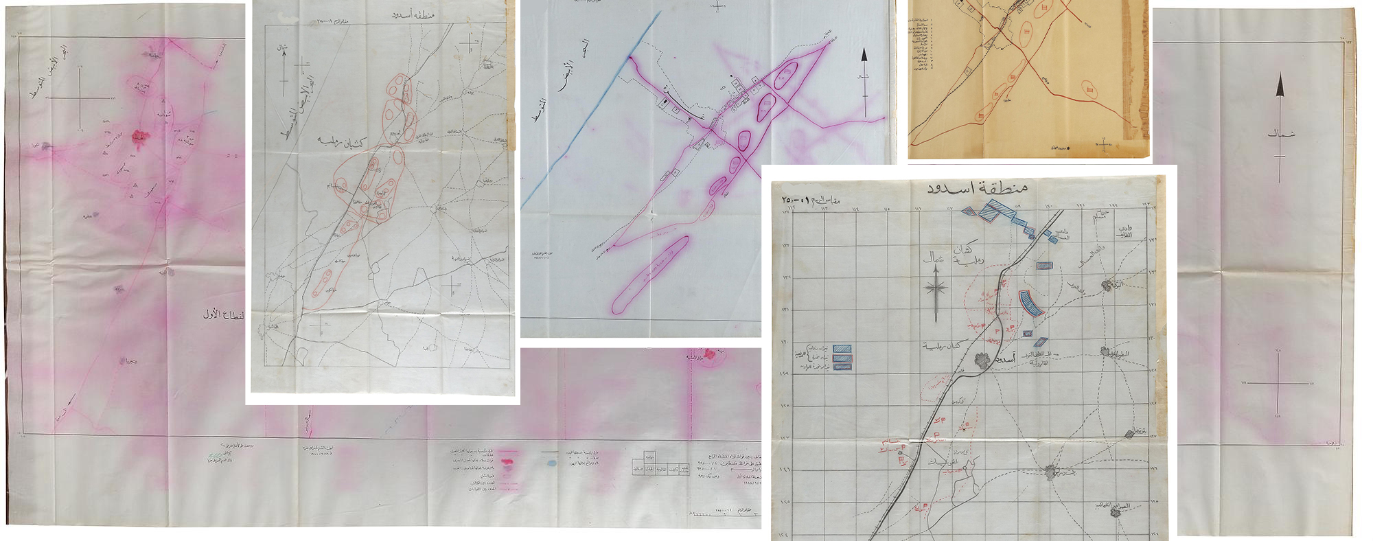
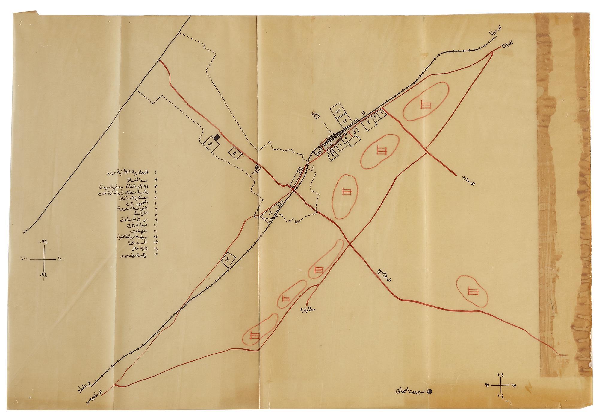
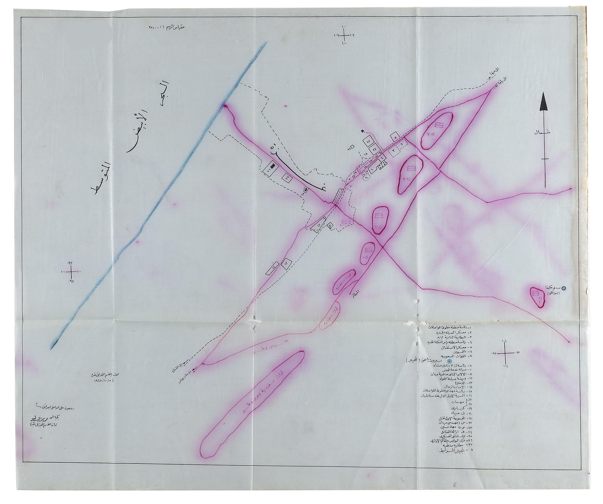
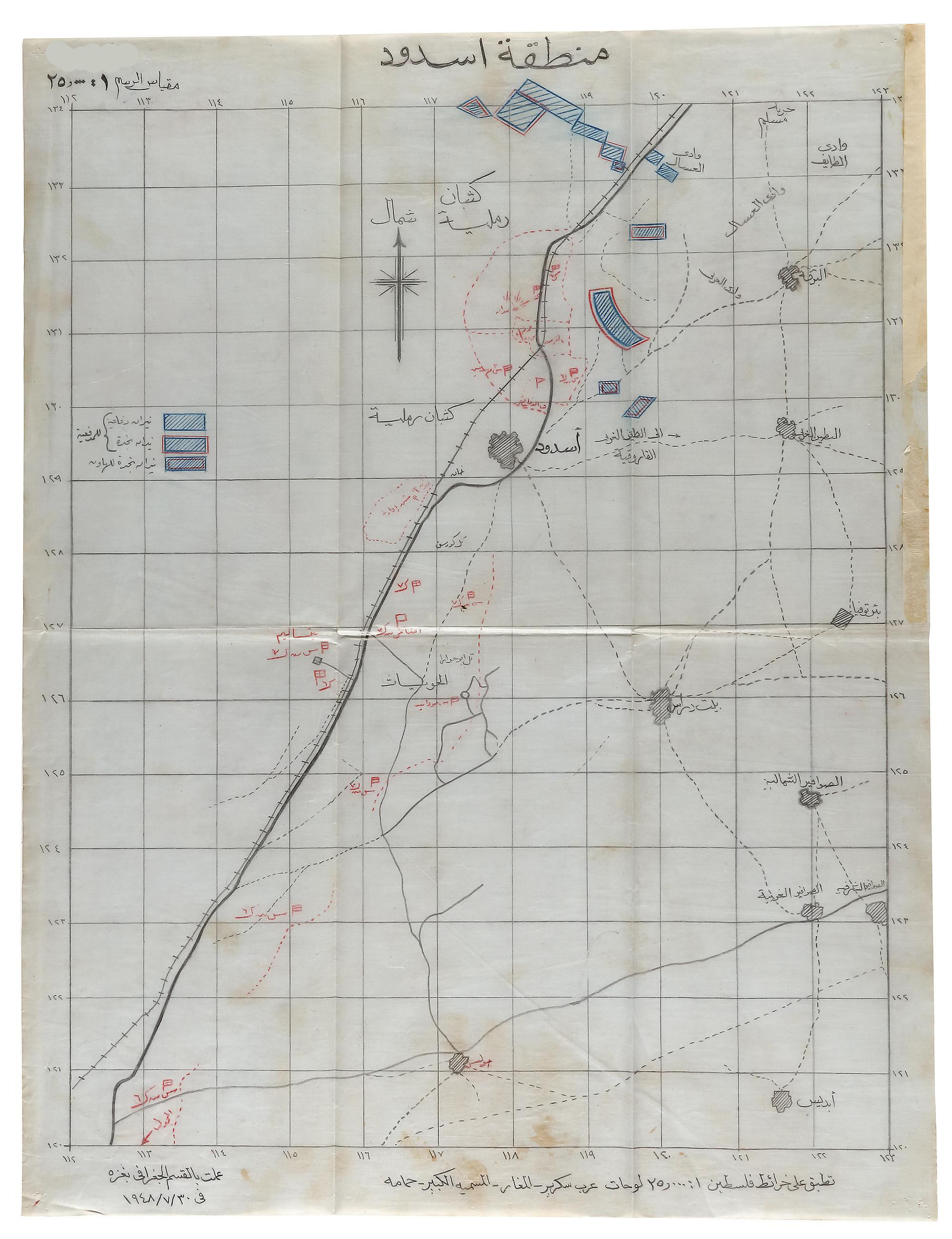
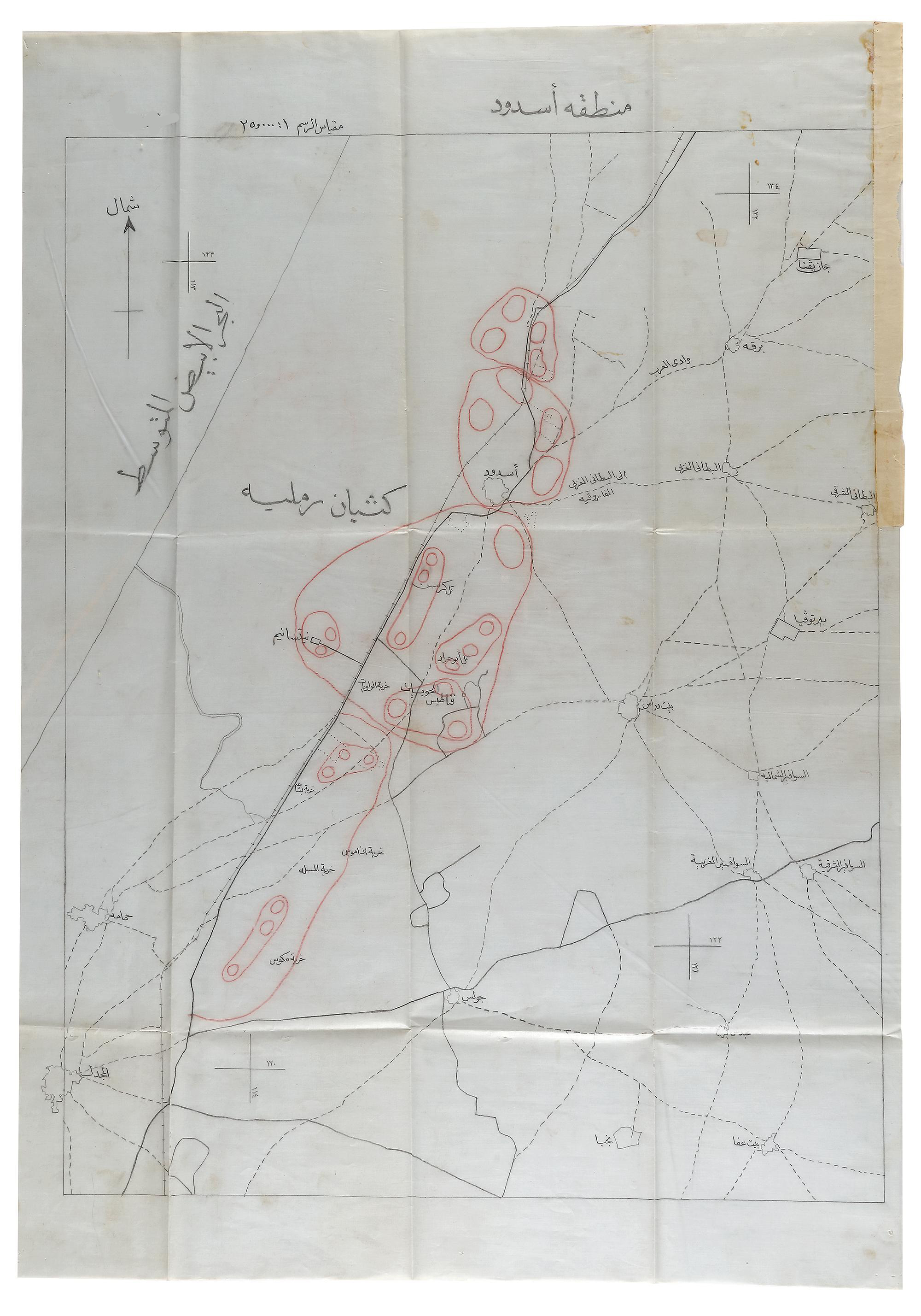
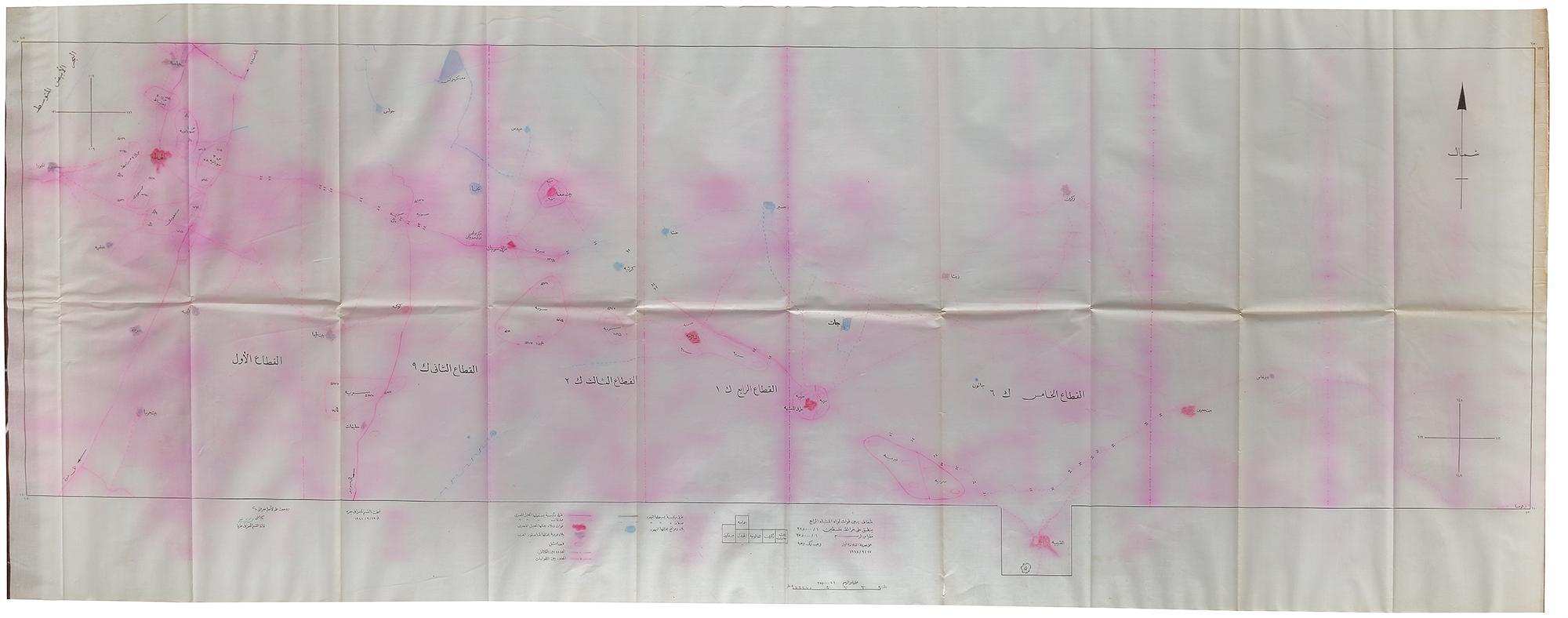
MIITARY MAPS AND DOCUMENTS SHOWING THE TOWNS/VILLAGES IN ASHDOD AND GAZA IN PALESTINE, PRINTED 5TH OCTOBER 1948 IN GAZA
Reference: ART4001085
A group of five maps of Gaza and Ashdod region, showing all the towns, roads, rivers, and villages for military strategic purposes used by the Saudi army. From: 51 by 34.5 cm. - 63 by 52.5 cm. - 174 by 68 cm.