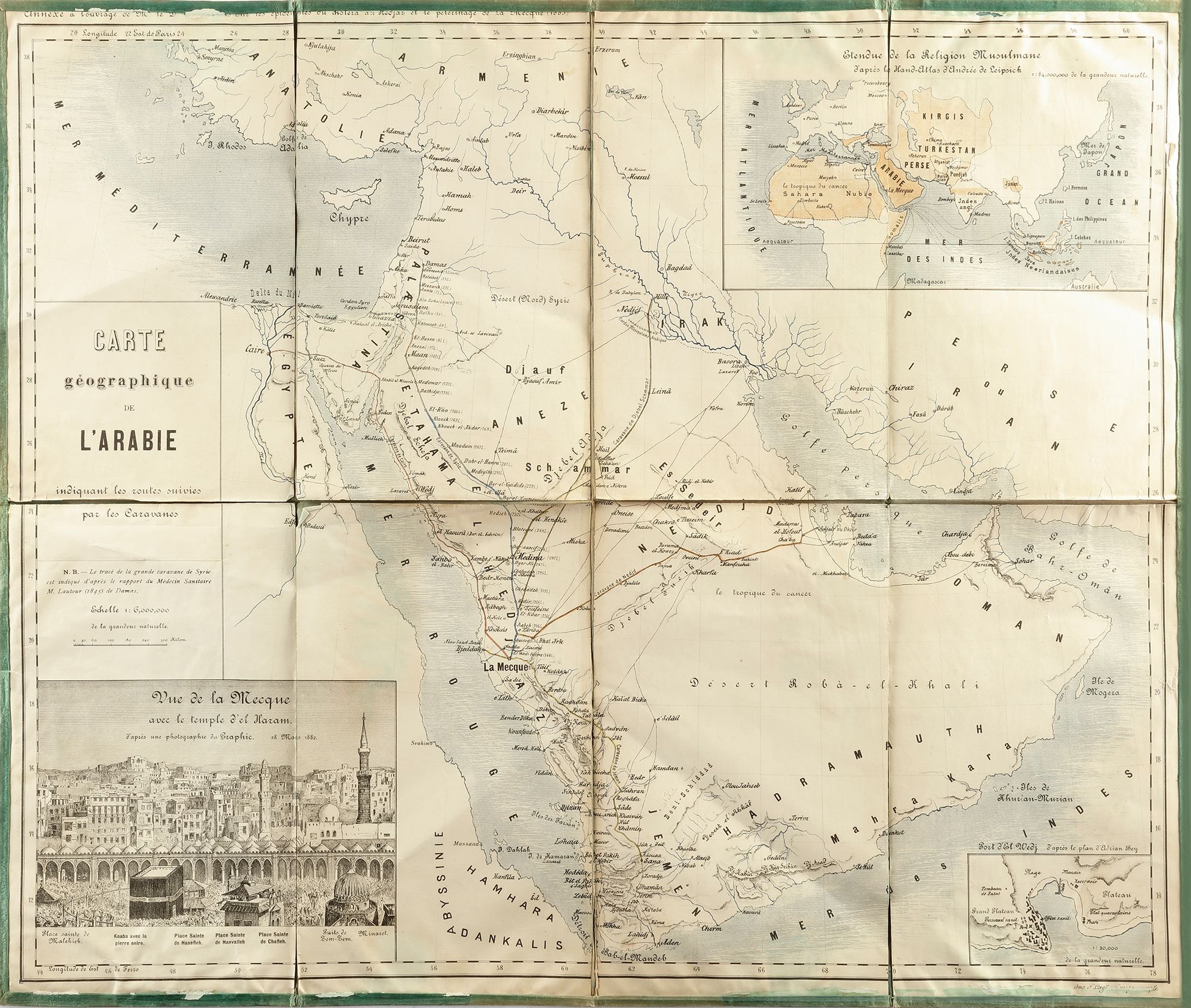
A FRENCH MAP OF ARABIA, DATED 1882
Reference: ART3002463
Manuscript map of Arabia, pen and ink on paper, indicates the routes followed by the caravans towards Mecca during the Hajj. The trace of the great Shami/Syrian mahmal according to the report of the doctor M. Lautour in Damascus 1845. In the upper right corner a smaller map of the spread of the islam, in the down left corner a smaller drawing of Al-Masjid Al-Haram in Mecca. 66 by 56.5 cm.