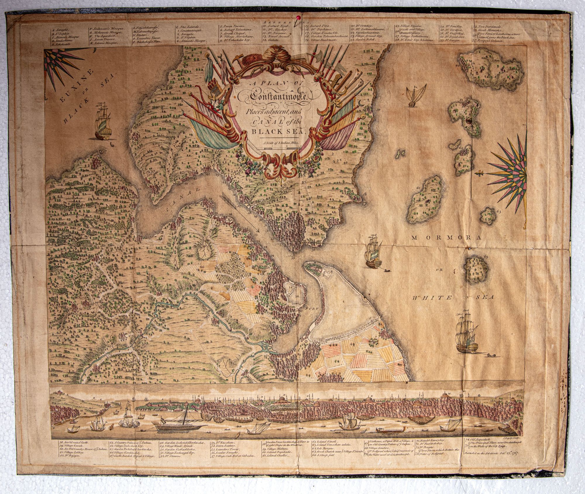

Lot 390 PLAN OF CONSTANTINOPLE AND THE BLACK SEA CANAL
Reference: ART700831
An ornate 18th-century map depicting Constantinople, its surrounding regions, and the canal linking the city to the Black Sea. Richly decorated with heraldic motifs, ships, and detailed landscapes, the map reflects European cartographic artistry and strategic interest in the city’s geography, waterways, and imperial importance 50 by 41 cm