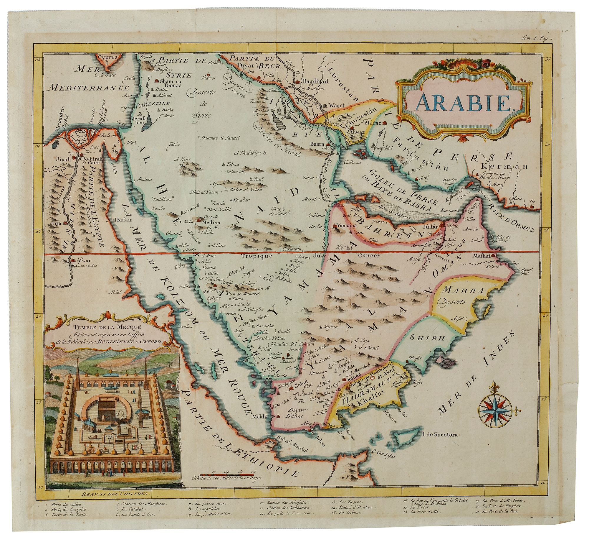
A FRENCH MAP OF THE ARABIAN PENINSULA WITH LARGE INSET OF THE GREAT MOSQUE OF MECCA, 18TH CENTURY
Reference: ART4001185
Decorative and detailed map cantered on the Arabian Peninsula, extending east-west from the Persian Gulf to Egypt and north-south from Syria-Palestine to Ethiopia. The geography is pre-Niebuhr but quite extensive in its detail, especially in its depiction of early 18th-century political divisions.
The distinctive feature that separates this map from other maps of Arabia is a large inset illustration of the Great Mosque of Mecca holy complex, executed from a drawing in the Bodleian Library at Oxford, and including a numbered key of important features.
37 by 34 cm.