A SILVER PORTABLE FOLDABLE OTTOMAN QIBLA FINDER WITH COMPASS AND DOUBLE SUNDIAL, 19TH CENTURY
Undated. 19th century.
Diameter: 8.5 cm.
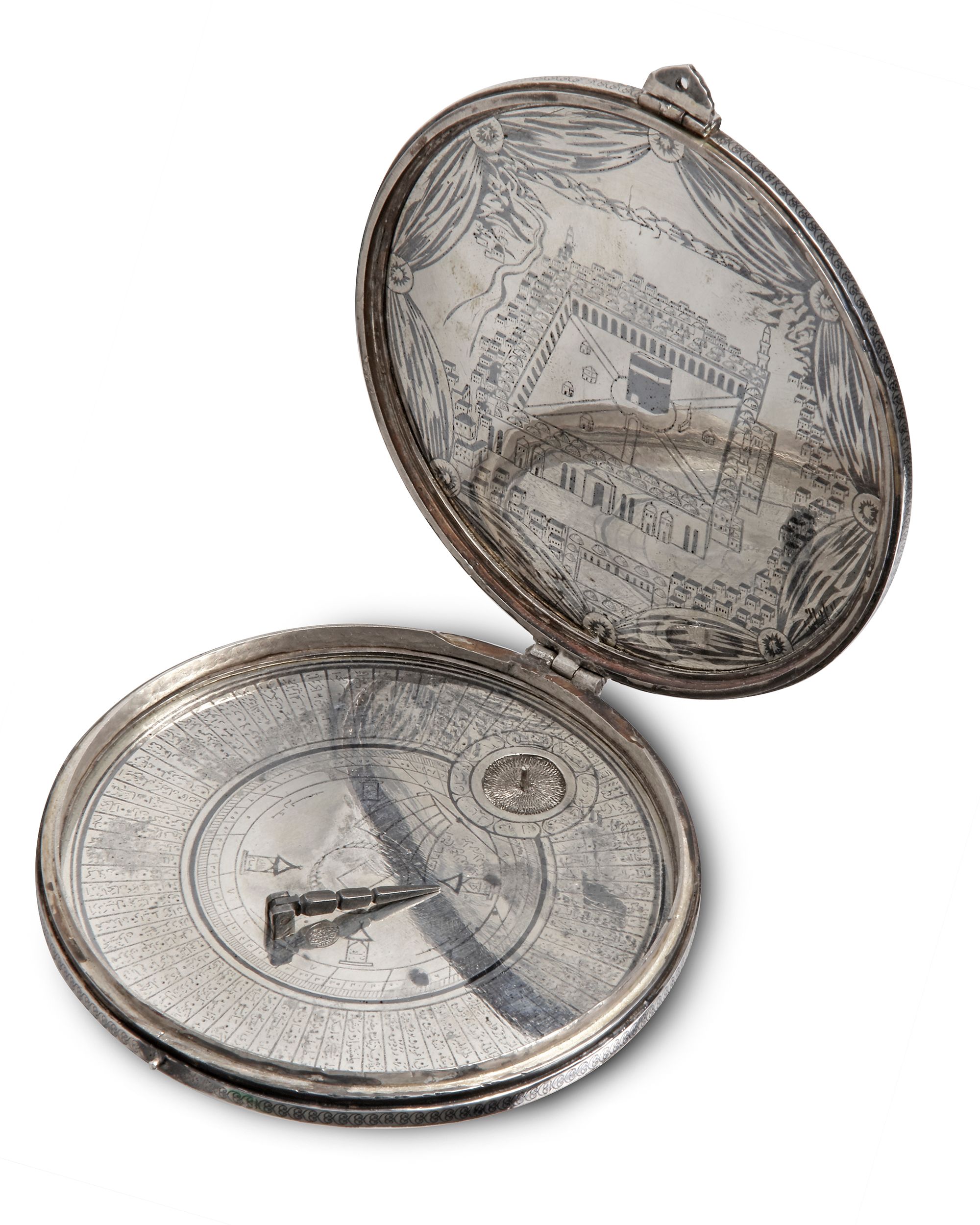
This small portable qibla finder features two sundials, a compass and a circular geographical table in the folk tradition of Islamic science known as a 72-sector scheme of scared geography indicating the qibla directions of groups of localities from the Islamic world. The markings and some of the mechanical characteristics of the instrument seem to be a direct copy of the ivory sundial qibla finder made by a certain Bayram ibn Ilyas in 1582, and which is now in the collection of the British Museum.
TECHNICAL DESCRIPTION
The Qibla finder engravings on this circular instrument are identical to the ivory sundial in the British Museum made by Bayram ibn Ilyas .
The technical description of the part which is identical to the British Museum instrument is as follows:
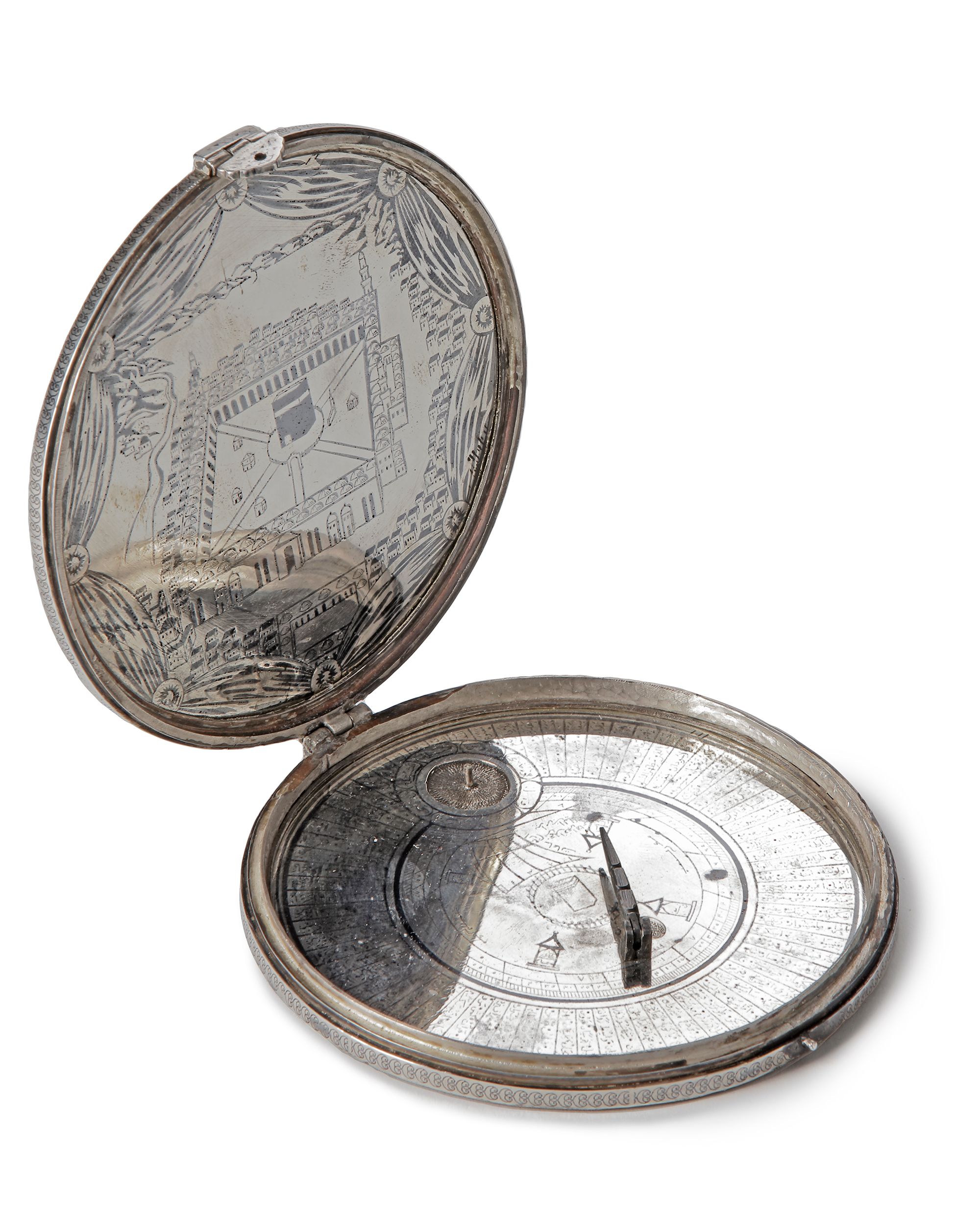
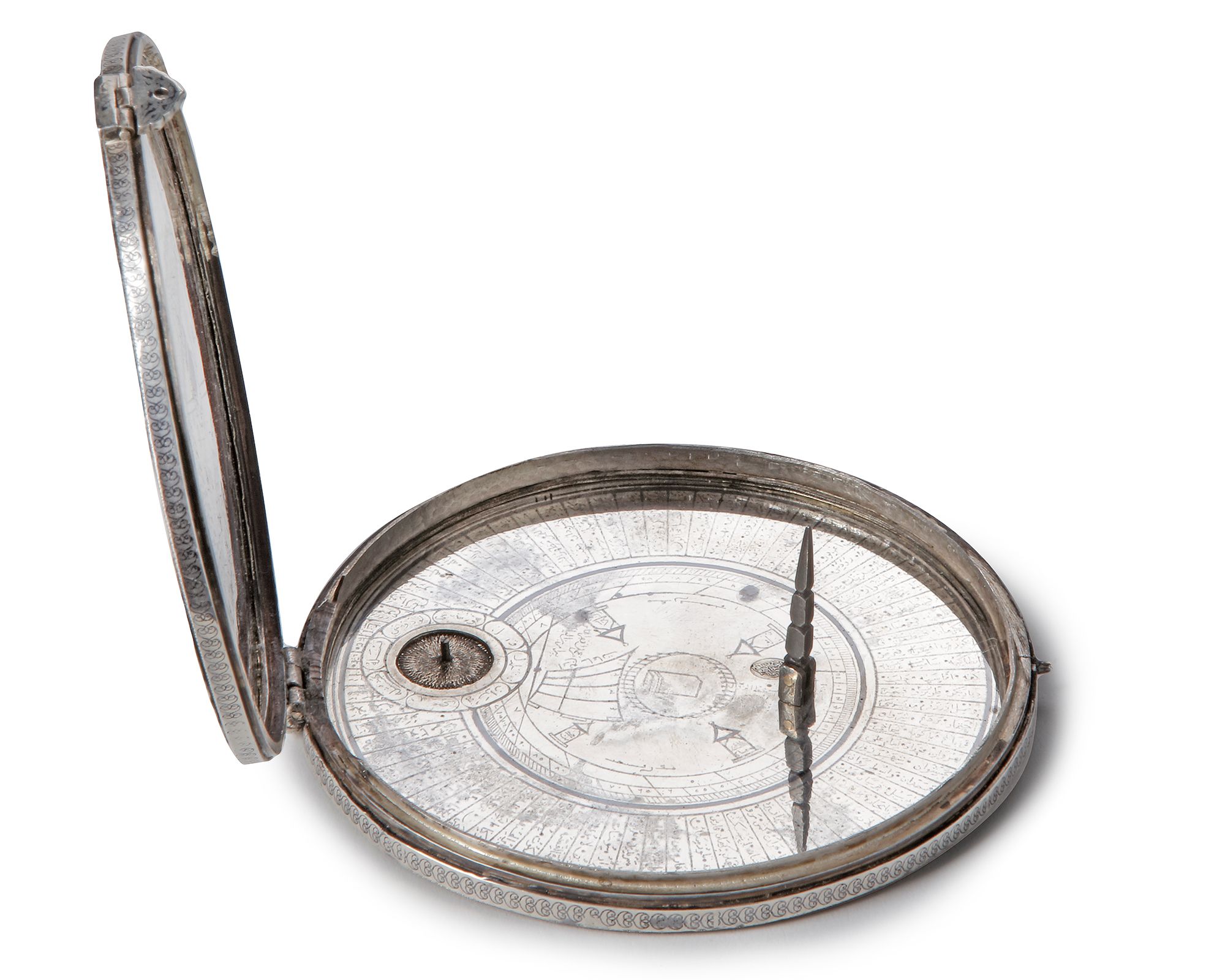
The qibla finder instrument consists of a circular table along the rim of the instrument featuring a 72- sector scheme of sacred geography (i.e folk tradition of Islamic science). Each quadrant is divided into 18 sectors of 5 degrees each and each of the sectors are inscribed with a group of cities/localities from the Islamic world.
Concentric to the circular table, bordering to the inner rim, are markings for the first sundial which shows the equinoctial hours and hour angle (with divisions for each degree).
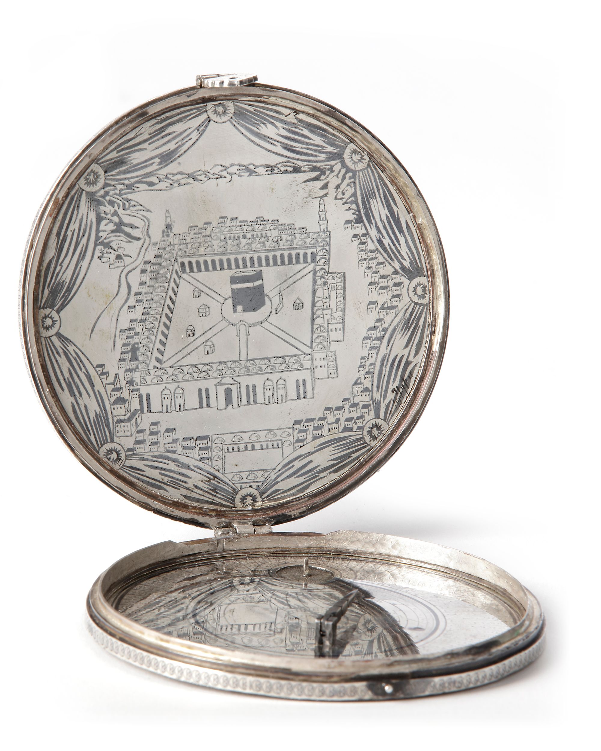
On the center of the instrument, there is a representation of the Ka’ba with a circular fence around it. Around the Ka’ba are the places of prayer (maqam) of the four legal schools. Below the Ka’ba, there is a second sundial in the shape of a scarlet sail, showing the time of the ‘asr prayer and each of the four hours before it.
Both sundials on the original British Museum instrument are facilitated by a string-gnomon pointing towards the celestial pole. The string-gnomon is held up by a collapsible strut. In this case there is a collapsible strut but neither the strut nor the instrument itself does feature a hole for attaching a thread. This might indicate that the instrument was intended as a decorative object.
On the left of the sail shaped marking there is a Turkish inscription indicating “oruç saati” (“fasting time”). Next to it the name of the maker: Bayram ibn Ilyas.
At the bottom of the instrument on top of the 180 degrees position of the circular table, there is circular hole for a magnetic compass.
In addition to the “Bayram ibn Ilyas” markings, the instrument furthermore features on the inner side an depiction of Masjid al-Haram in Mecca and it’s surroundings inside the upper lid. On the inside of the lower lid the needle of the magnetic compass is missing.
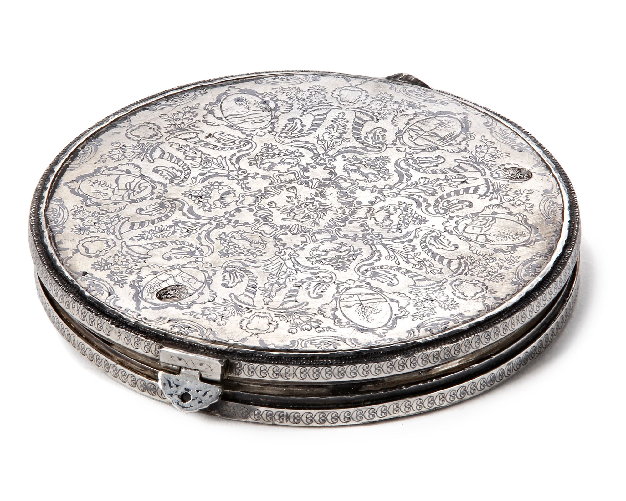
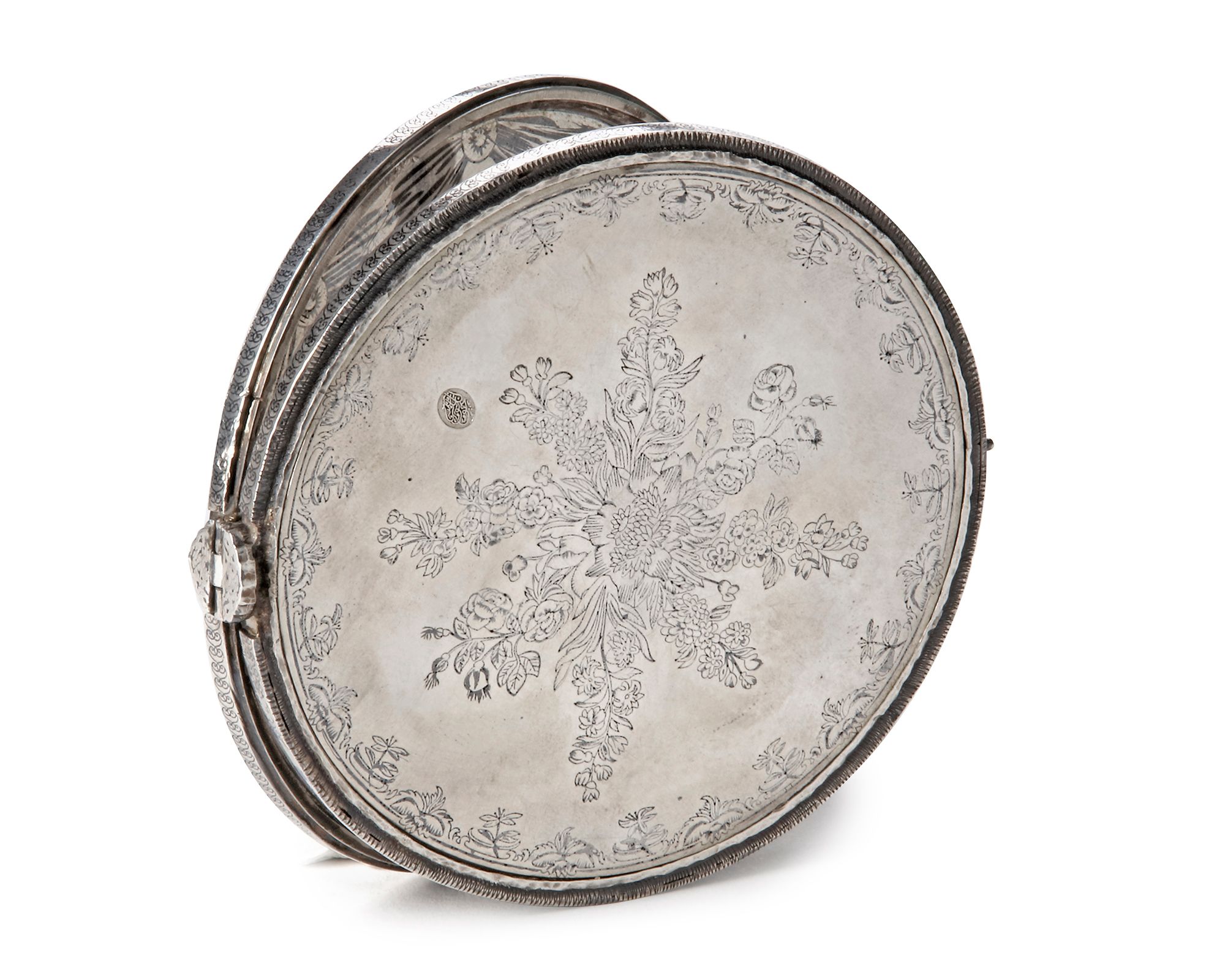
The instrument features some stains rendering some parts of the instrument unreadable. On the outside the instrument is decorated with various floral and other decorative patterns. The decoration on the upper lid additionally features oval insets with depictions of “natural scenes”.
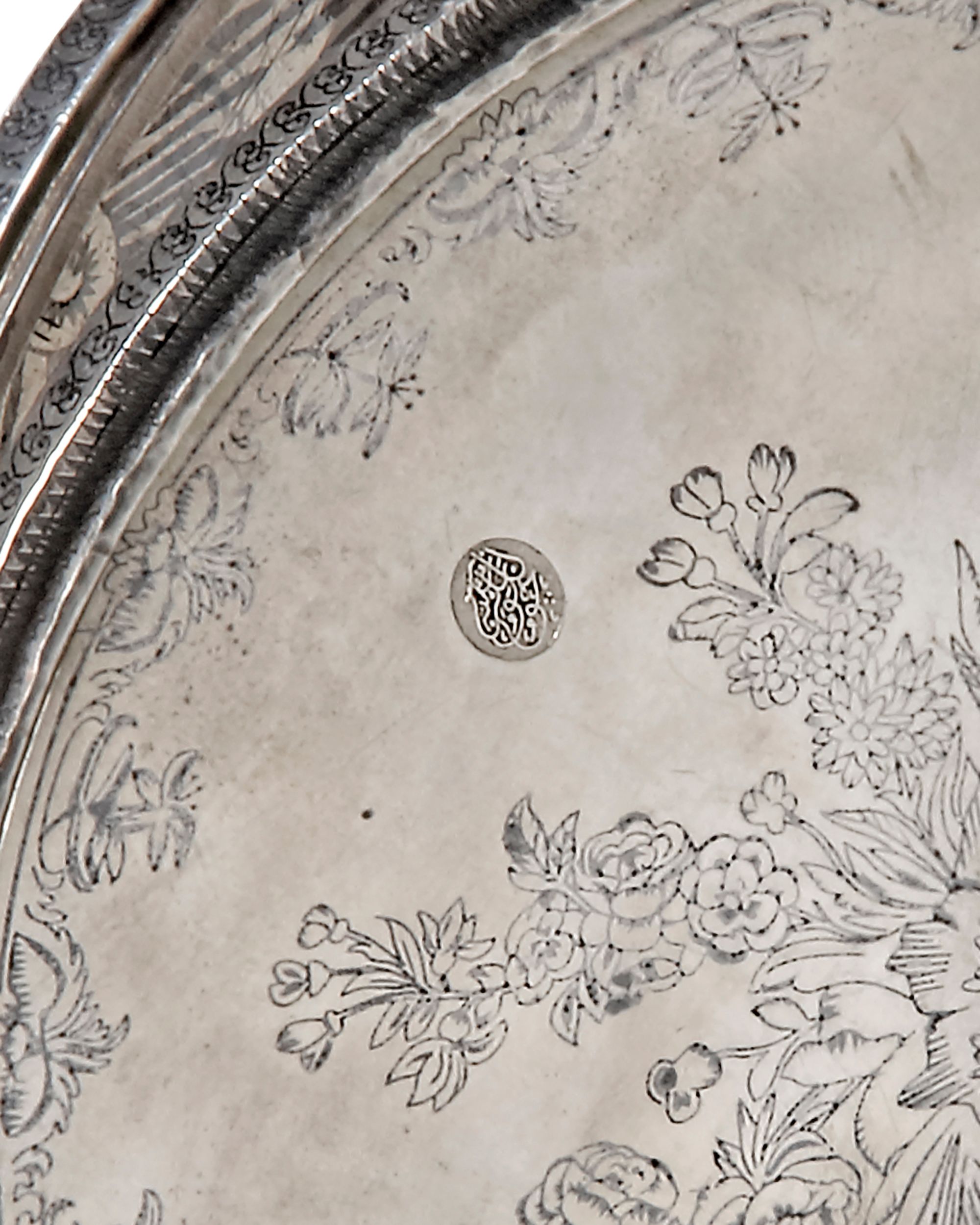
The instrument bears four silver marks: two on the outside of the lower lid, one on the dial itself and one on top.
LITERATURE
For more detailed information on the ivory sundial on which this qibla finder is based see:
Meghan Doyle, “The Whole World in His Hands: What a Qibla Indicator Illuminates About Islamic Community in Sixteenth-Century About Islamic Community in Sixteenth-Century Ottoman Turkey”, Global Tides: Vol. 12 (2018) , Article 8. Available at: https://digitalcommons.pepperdine.edu/globaltides/vol12/iss1/8
David King, World Maps for Finding the Distance and Direction to Mecca: Tradition and Innovation in Islamic Science. Brill, Leiden, 1999, p. 116-117
Venetia Porter, The Art of Hajj: Journey to the Heart of Islam, British Museum Press, London, 2012, p. 66