TWO ANTIQUE MAPS OF JAPAN AND THE KURIL ISLANDS
Reference: ART2002027
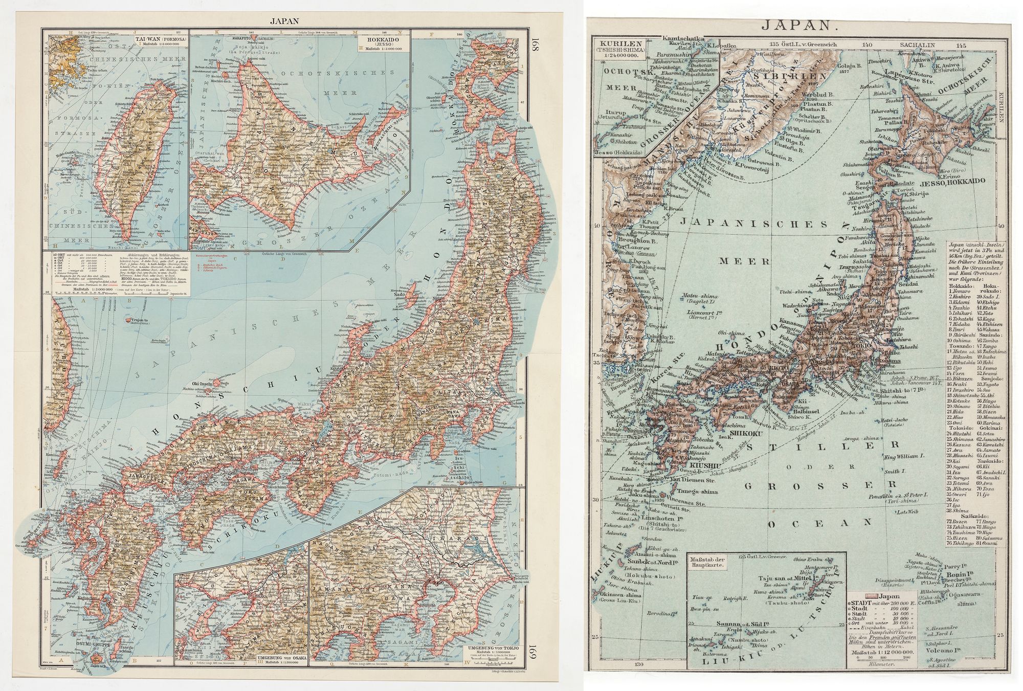
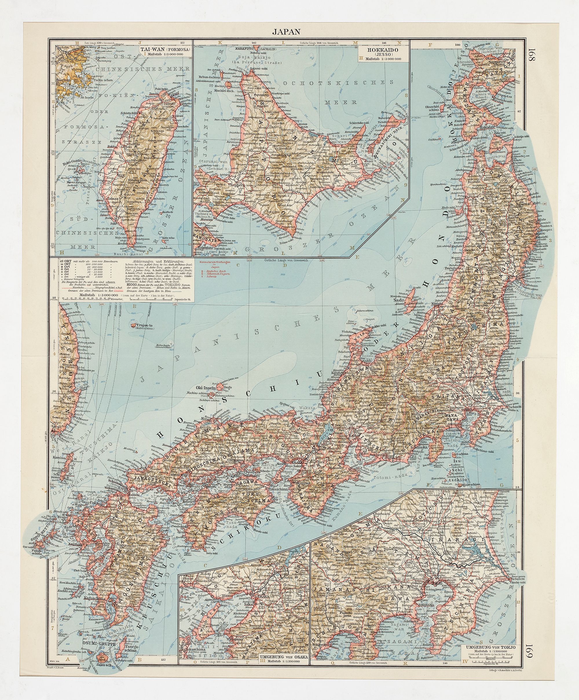
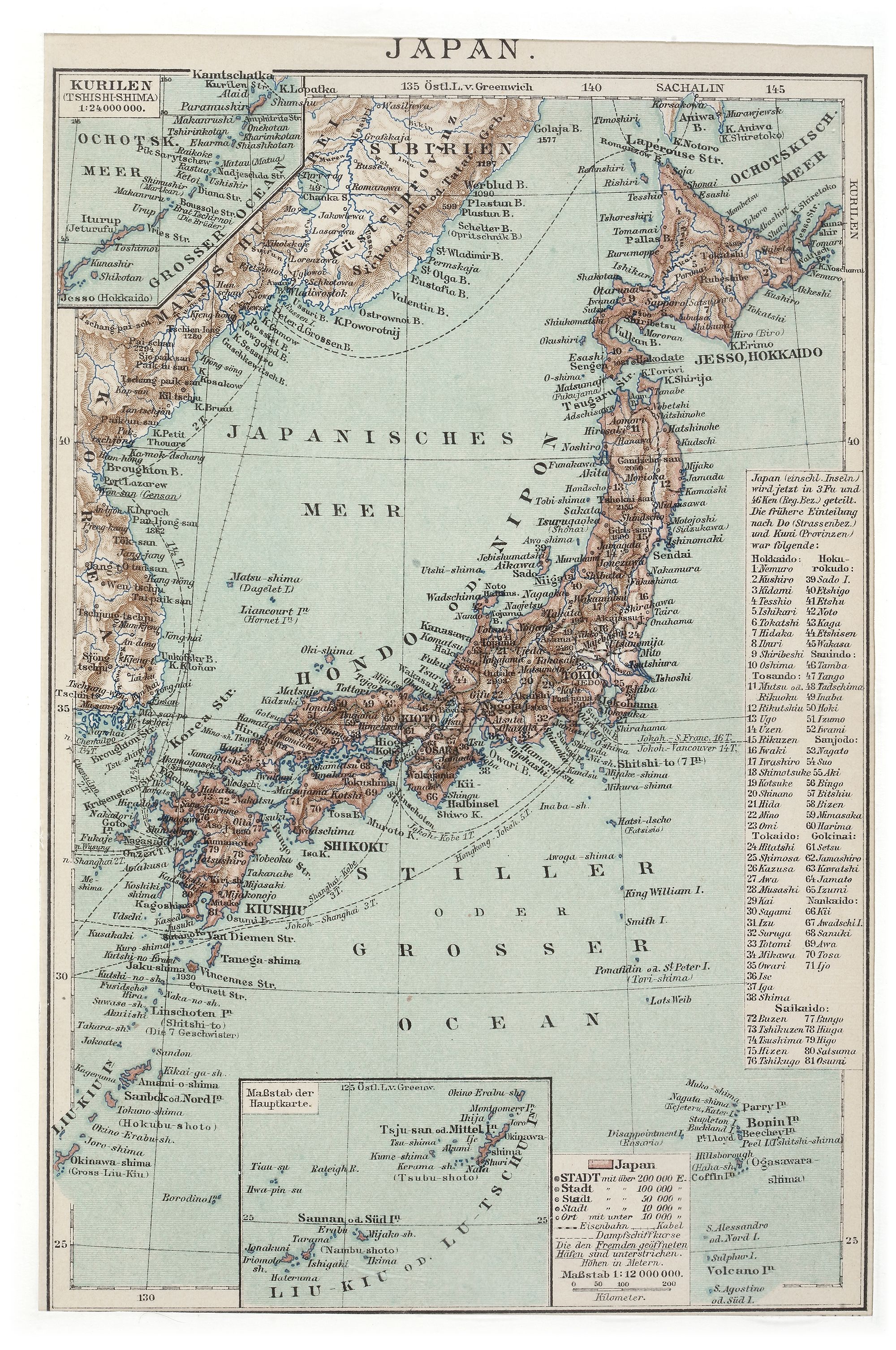
A historical map of Japan, including detailed depictions of its main islands (Honshu, Hokkaido, Kyushu, and Shikoku) and surrounding territories such as the Kuril Islands (“Kurilen” or “Tshishi-Shima”). The map features German-language labeling and intricate cartographic details, including topography, city names, and bodies of water such as the “Ochotskisches Meer” (Sea of Okhotsk) and the “Japanisches Meer” (Sea of Japan). The inset scale indicates a ratio of 1:24,000,000 for the Kuril Islands.
22 by 14.5 cm.
52 by 42 cm.