MAP OF NANJASAKI, 18TH CENTURY
Reference: ART2002015
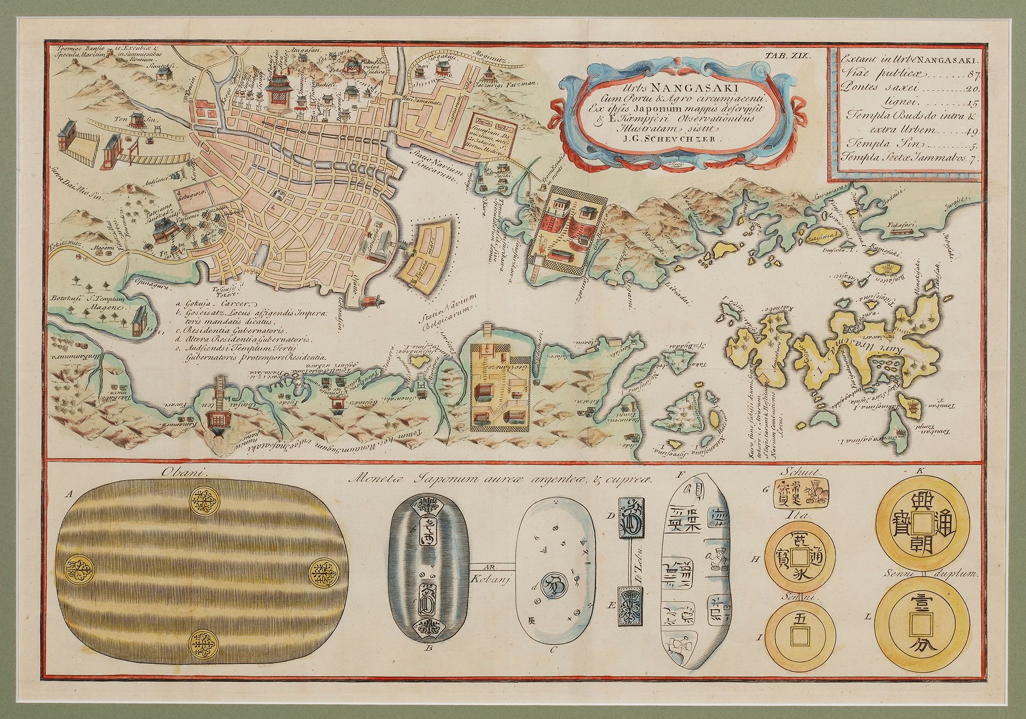
A richly detailed historical map of Nagasaki, Japan, based on Japanese sources and the observations of Engelbert Kaempfer. The map presents an elaborate plan of the city, highlighting key structures, temples, and infrastructure such as public roads and bridges. It also includes a detailed depiction of Deshima, the artificial island where the Dutch trading post was located, symbolizing Japan’s controlled foreign trade during the Edo period. The lower section showcases Japanese currency, including gold, silver, and copper coins. This map serves as a valuable historical record of Nagasaki’s urban landscape and economic importance in the early modern period.
Cartographer: J.G. Scheuchzer.
18th century.